
High-accuracy Ground Control Points for satellite, aerial and UAV/drone mapping — all over the world
Centimeter-level positional accuracy · 130+ countries · ISO 9001:2015 certified
Centimeter-level positional accuracy · 130+ countries · ISO 9001:2015 certified
KPGeo plans, measures, documents and delivers Ground Control Points and independent check points (ICPs) worldwide — available on demand or directly from an extensive global archive — providing photogrammetric control for satellite imagery triangulation, aerial triangulation, orthophoto georeferencing and UAV/drone mapping, at centimeter-level positional accuracy.
We collect GCPs almost anywhere on Earth.
Every point is quality-controlled before delivery.
Professional GNSS receivers and high-precision positioning methods deliver survey-grade geodetic control points.
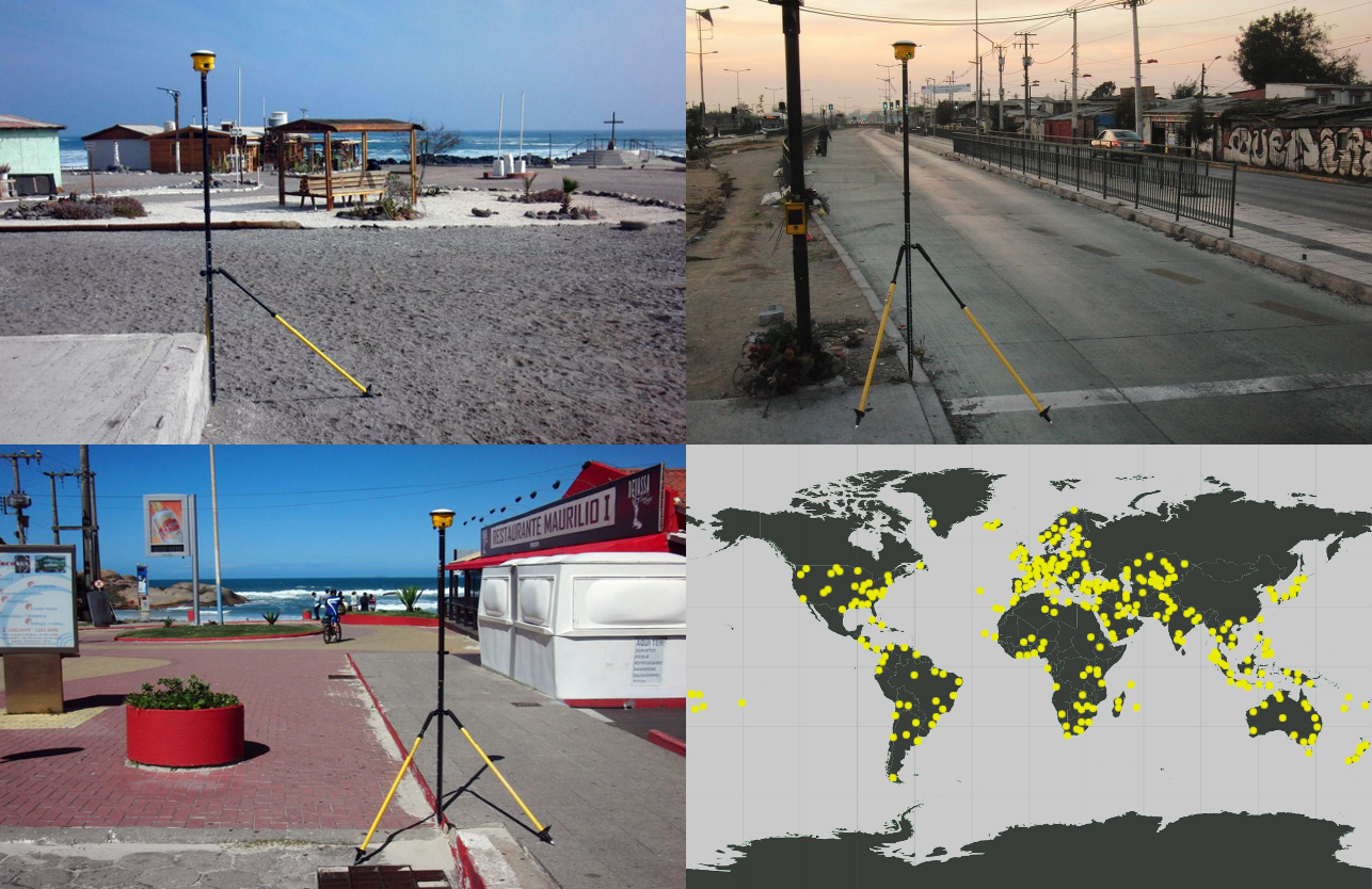
Since our first survey in 2011, KPGeo has built one of the world’s largest commercial GCP archives — 8,500+ Ground Control Points at 700+ locations across 130+ countries and all six inhabited continents, from Arctic Norway and Greenland to southern Chile.
We never lose sight of what is at stake: the accuracy of an entire photogrammetric project — orthophotos, DSMs, 3D models and every derived measurement — is only ever as good as its Ground Control Points. That is why rigorous quality control is built into every step of our work, not bolted on at the end.
From energy to aviation, our Ground Control Points make imagery measurably accurate across every industry — for satellite, aerial and UAV/drone mapping.
Airport control for AMDB, eTOD and orthophoto — 700+ airports surveyed.
Georeferenced control for PV plant design, grading and as-built verification.
High-accuracy GCP for UAV/drone mapping — control and check points for drone orthomosaics and DSMs.
Consistent positioning for roads, rail, pipelines and power lines.
Send your area of interest, target accuracy and coordinate system.
We plan the number and distribution of GCPs and prepare reference imagery.
Every point measured using high-precision GNSS positioning methods.
Each point validated against your specification (ISO 9001).
Full package handed over — see what you get on the right.
This is our live archive of 8,500+ real Ground Control Points measured across 130+ countries. Draw an outline around your area of interest to see the points inside it — with accuracy and capture date — and export them to CSV or KML.
8,500+ points you can preview right now